
Projects
My research is divided into three interconnected categories: Governance and informality, food retail, and methods. These areas inform and build upon one another in my work.
Governance and informality
Power of street vending associations and state formation in Mexico City
Public space is a key element of the spatial organization of cities, shedding light on the relationships between state and society. At least from the 19th century, street vendors have claimed and negotiated with Mexico City’s government their access to public space in order to make a living. However, the evolution of street vending associations in their relationship with how the state shapes and controls these associations beyond clientelist practices, and how it has varied across boroughs outside of the Historic Center has not yet been examined. In this context, this project examines the extent to which street vending associations regulate and manage public space. This project focuses on an over-time comparison at the city level over the course of three periods of time that cover the rule of three different political parties: pre-1997 (PRI rule); 1997-2018 (Partido Revolucionario Democrático, PRD rule); 2018-today (Movimiento de Regeneración Nacional, MORENA rule).
The implementation of a street vending ordinance in the Mission District, San Francisco

The government framed the urgency of creating the street vending ordinance around the conspicuous vending of stolen goods and drugs happening outside the 24th and Mission subway station. However, the street vending ordinance missed its target, implementing regulatory measures for street vendors that were not involved in selling stolen goods or drugs. This study examines the reaction of vendors, community organizations, and street level bureaucrats (e.g., district supervisors, public works officials, and police officers) to the implementation of the street vending ordinance. In particular, this project traces the dynamism of the implementation and explores the unintended socioeconomic consequences of its implementation at the city level.
Mobility of informal workers in Mexico City
While cities craft policies to regulate work in the formal labor market, where jobs are more secure, well-remunerated with health and other benefits, cities do not consider regulation of work within the informal labor market. Although street vendors are the most visible form of informal work, little is known about their daily mobility patterns and how that affects their relationship with vendor organizations, street level bureaucrats, and local elected officials. Using the location of informal street markets in Mexico City, I use Location Based Services (LBS) data to capture people coming into the region of interest (street market) and identify them as vendors, identify their home location, and their mobility patterns across the city. This analysis will allow me to identify the percentage of workers that live within the same municipality in each street market, allowing me to further examine if local workers gain greater political leverage to remain in place through 1) stronger community networks as a more homogeneous group or, 2) by having a stronger clientelistic relationship by being part of the local politicians’ jurisdiction.
Food
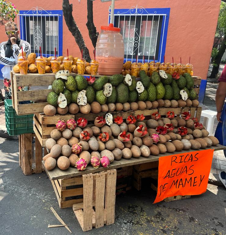
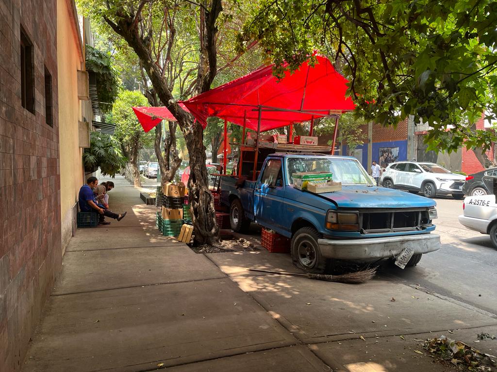
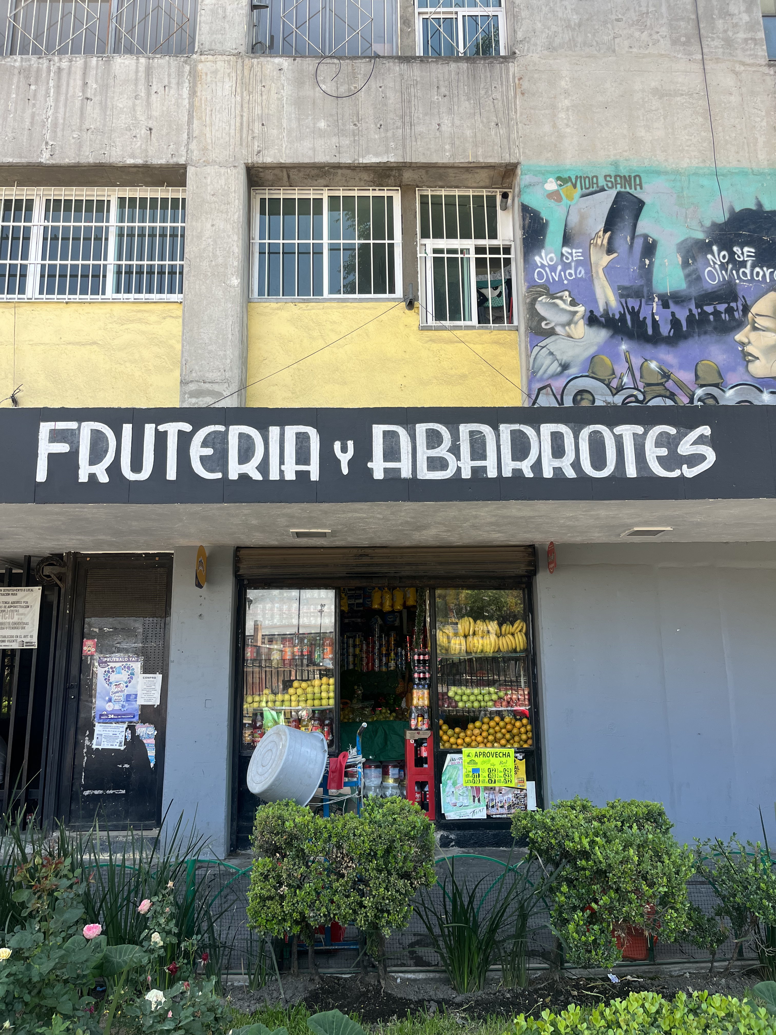
Retail food environment and incorporating informal food outlets in food policies in Mexico
 I study the retail food environment in Mexico, shedding light on how households purchase from a myriad of food and beverage outlets and the importance of incorporating informal outlets in food policy interventions. The results show that the largest proportion of food purchases are carried out in small neighborhood and specialty stores (i.e., abarroterías and tiendas de ramo) and that there is no clear categorization of healthy/unhealthy outlets. However, the largest proportion of unhealthy foods was purchased at small neighborhood, convenience stores, and supermarkets. In contrast, healthy food purchases were higher in street markets, public markets, and specialty stores. The results show that to ensure food security and access to healthy foods, food policies should incorporate the informal food sector and account for varying degrees of food quality according to the location and context of the population under study. (jointly with Dalia Stern and other co-authors). View Food and beverage purchases at formal and informal outlets in Mexico, Trends in food and beverage purchases in informal, mixed, and formal food outlets in Mexico: ENIGH 1994-2020, and Changes in the healthfulness of food and beverage purchases from 2006 to 2022 by outlet type in Mexico.
Methods
Predatory behavior of food retail in Mexico City
Previous research states that over the last two decades, a greater density of supermarkets and convenience stores has increased in the global south, putting at risk the survival of small businesses in neighborhoods. Another strand of research has recognized that despite the increase of corporate food businesses, a wide variety of food retailers, such as small neighborhood stores and street markets still predominate, and the presence of the informal food sector is ubiquitous. However, this research has focused on food consumption patterns and has not examined the likelihood of small businesses to survive in the presence of a new corporate business in a neighborhood. This project will empirically analyze if corporate businesses have been displacing smaller businesses in the case of Mexico City. Basing our work on the demography of businesses, we will employ spatial point pattern analysis to examine if the “birth” of corporate businesses “kill” small businesses from 2010 to 2015, and from 2015 and 2020. We will rely on the shared component model based on the log Gaussian Cox process model for initial analysis (jointly with Claire Kelling).
Firm demography
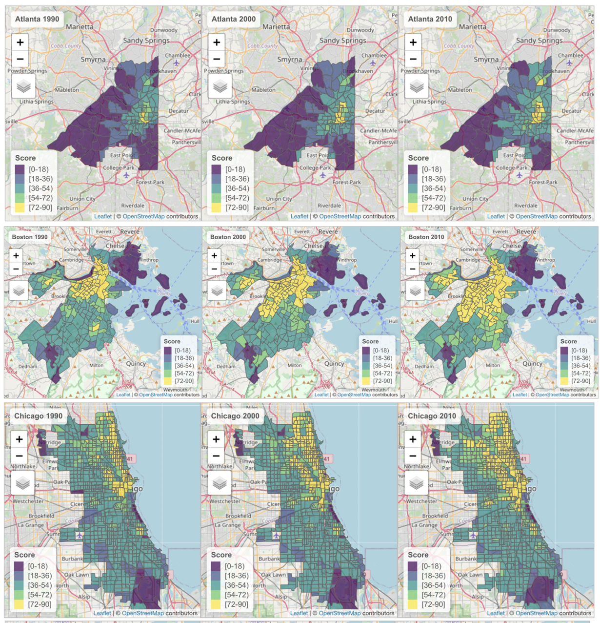 Firm demography employs the methods of human demography to analyze events in the life span of establishments and institutions, such as their birth, death, aging and movement patterns. I examine the demography of firms in the United States by using life tables to analyze the probability at which different firm sizes survived or died over time in different geographies: Atlanta, Boston, Chicago, Miami, Phoenix, and Seattle. I also study the co-location of large chain stores with smaller independent hardware stores, analyzing the predatory behavior of corporate businesses through point pattern analysis (jointly with Luc Anselin). View chapters in Streetlife: The Future of Urban Retail.
Enumeration of street vendors through satellite images
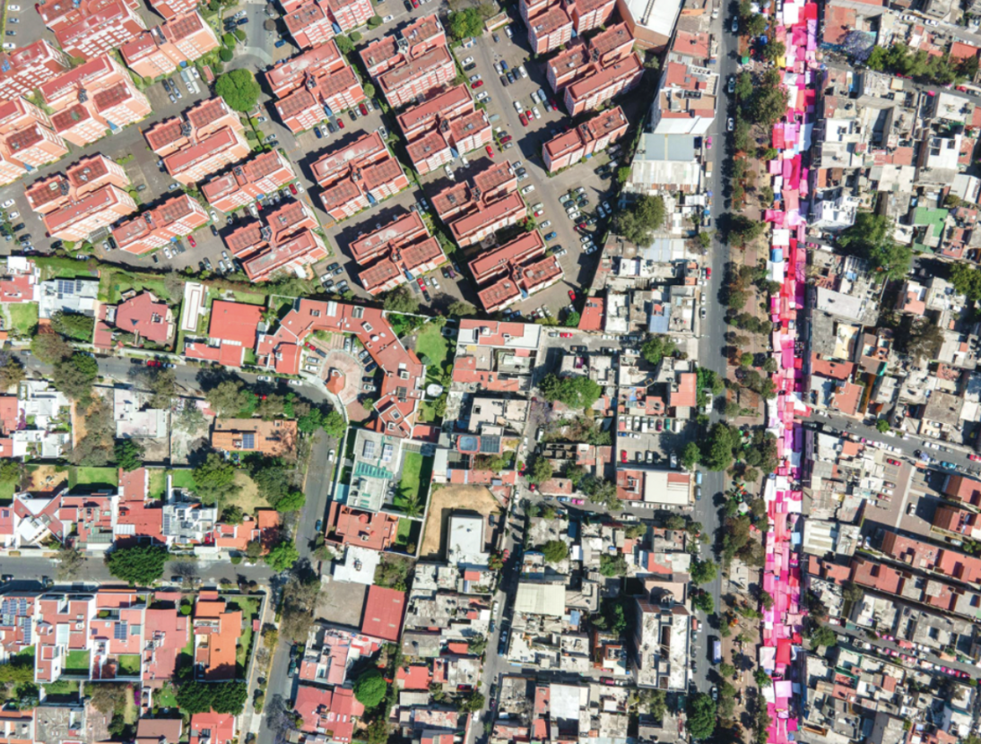 The existence of street vendors in public space is as contentious as collecting data of their location. The purpose of this research is twofold: 1) to generate an algorithm through computer vision that quantifies fixed street vendors at a large scale; and 2) to carry out analyses between the density of vendors and neighborhood characteristics to assess if the number of people working in public space is associated with socioeconomic status, political party, or the level of presence from vendors’ associations. In order to carry out these analyses I will use images near subway stations from Google Street View and detect street vendors’ stalls by deploying computer vision techniques.
Spatial accessibility
 I examine the sensitivity of access metrics by estimating the walking distance metrics at a tract level to assess their differences across time for 6 cities: Atlanta, Boston, Chicago, Miami, Phoenix, and Seattle. I measure and compare 12 spatial potential access models metrics with varying parameters that determine them: the distance decay function, maximum time threshold to which people walk to an amenity, number of amenities included within the threshold, and the weights that each amenity should have. Assessment of the parameters defining gravity-model and potential accessibility measures is crucial, given that there is no consensus on which thresholds to set. I then estimate the sensitivity of these models by comparing it to the 2011 Walk Score® which has devised an official nation-wide scoring method for walkability (jointly with Luc Anselin, Kevin Credit, and Emily Talen).
Development of a teaching curriculum on critical spatial data science
 This project examines how to jointly teach critical GIS and technical mapping methods by creating teaching strategies to answer:
(1) How to think spatially?
(2) How to carry out exploratory spatial analysis?
(3) How to incorporate critical thinking using technical tools to examine spatial inequities?